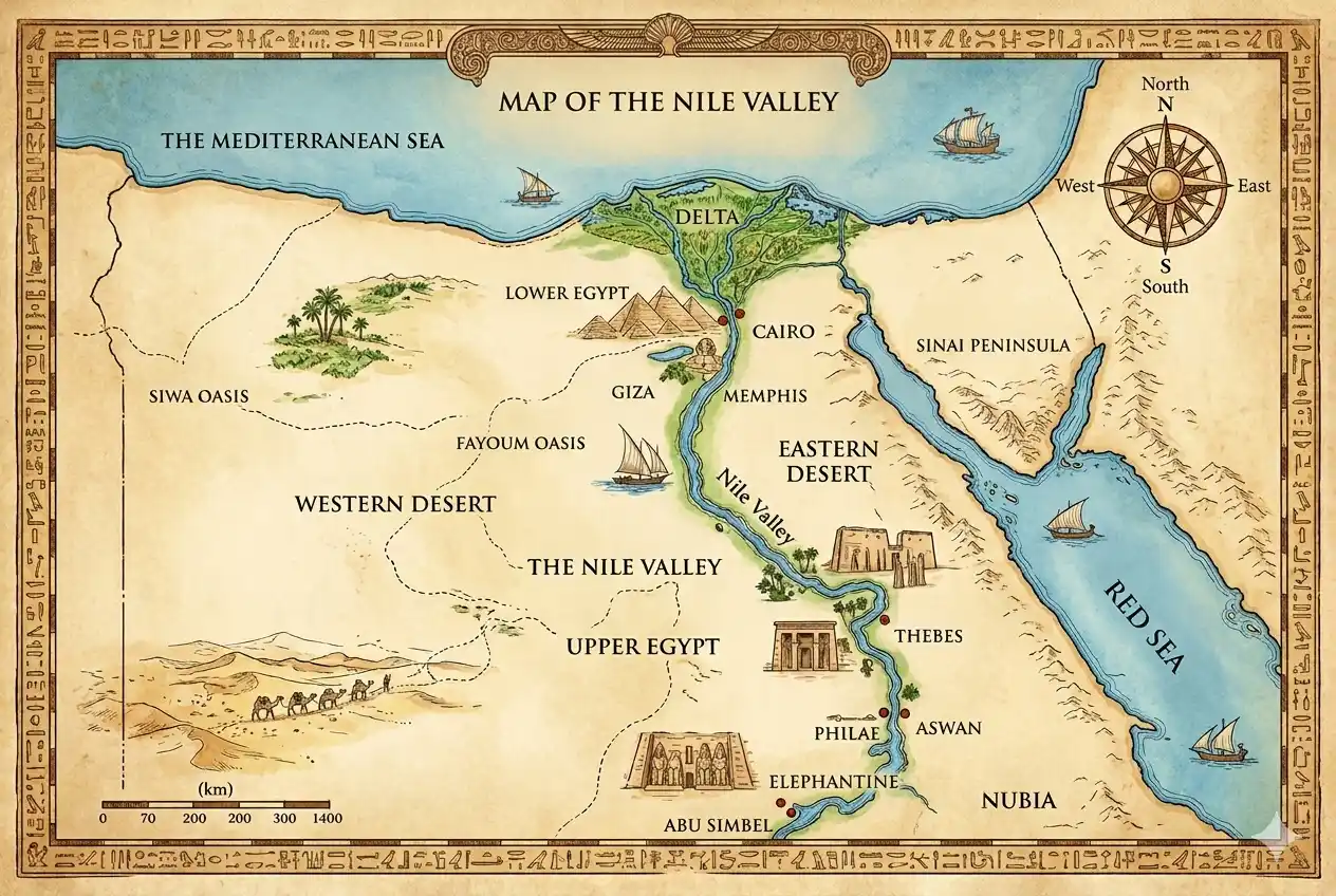
A map of the Nile River Valley is really a map of Egypt itself — 95% of the country’s life squeezed into a green ribbon rarely wider than 20 km, running 1,000+ km from Aswan to the Mediterranean fan of the Delta. Read the map right and every itinerary plans itself. Here it is, decoded stop by stop.
Quick Answer: The Nile Valley runs south-to-north: Abu Simbel and Lake Nasser at the far south, then Aswan (the old frontier), the temple corridor of Kom Ombo and Edfu, Luxor (ancient Thebes), the holy bend at Abydos and Dendera, Middle Egypt, Cairo and Giza where the valley meets the Delta, and finally Alexandria on the sea. Rivers flow north here — so “Upper Egypt” is the south.
Reading the Map Like an Egyptian
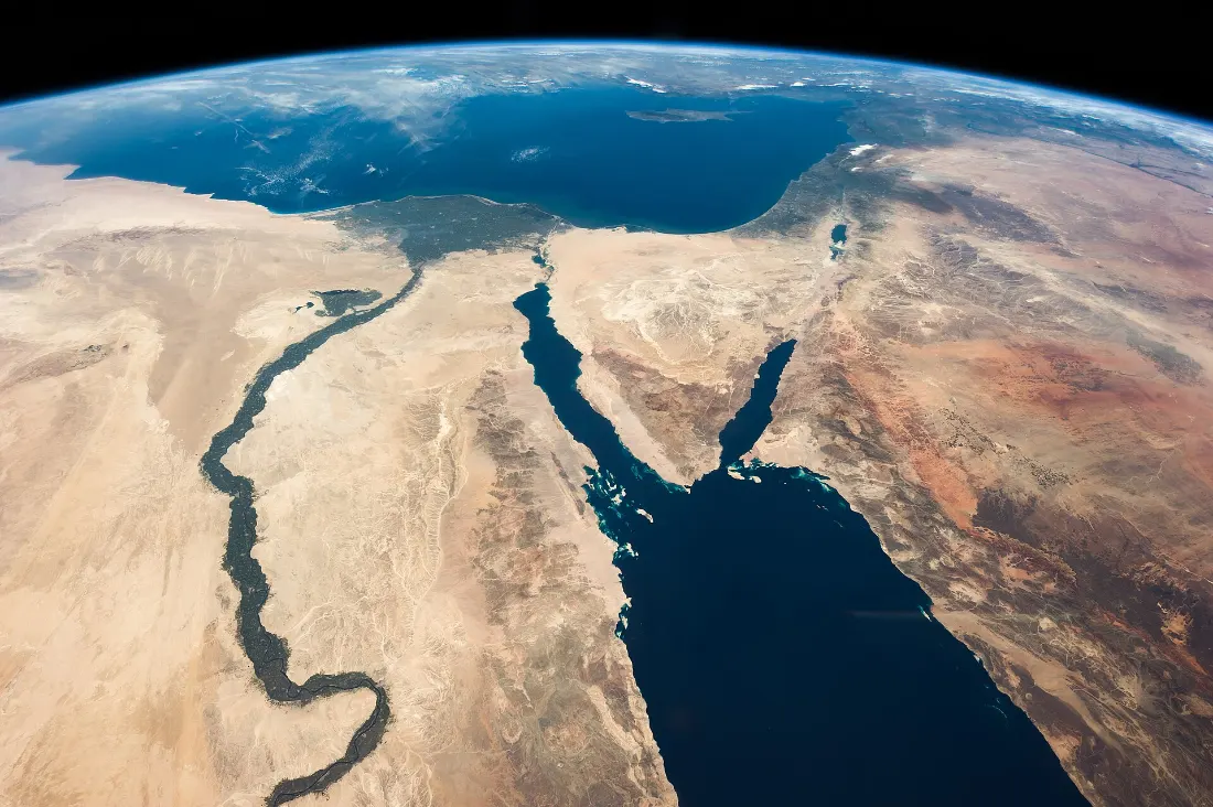
Two orientations unlock everything. First: the Nile flows north, so Upper Egypt = upstream = south — Luxor and Aswan — while Lower Egypt is the Delta. Second: the sun ruled the banks — the east bank (sunrise) held the cities and temples of the living; the west bank (sunset) held the tombs. That is why Luxor’s monuments split so neatly across the river.
The Valley, South to North
| Stop | What it is | Travel note |
|---|---|---|
| Abu Simbel | Ramses II’s rock temples on Lake Nasser | 3 h from Aswan |
| Aswan | Granite frontier: Philae, Elephantine, Nubia | Cruise start/end |
| Kom Ombo | The double temple of Sobek and Horus | Cruise stop |
| Edfu | Egypt’s best-preserved temple | Cruise stop |
| Luxor | Thebes: Karnak + Valley of the Kings | The valley’s crown |
| Dendera & Abydos | Best-preserved interiors, holiest ground | Day trip north of Luxor |
| Cairo & Giza | Valley meets Delta; the Pyramids | Flight or sleeper train |
| Alexandria | The Mediterranean gate | Day from Cairo |
Why Everything Hugs the River
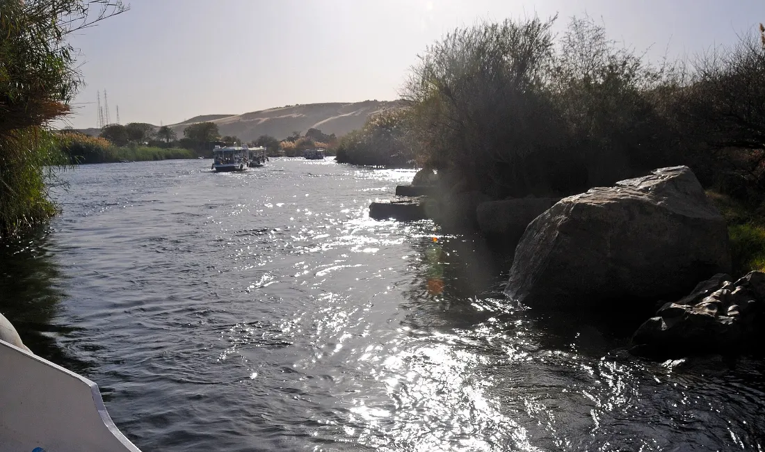
Rainless Egypt lives on the flood’s old floodplain: the black land (kemet) of silt against the red land (deshret) of desert — you can still stand with a foot in each. The desert’s dryness is the archaeologist’s best friend: it preserved everything the valley built, from tombs to the workers’ bread. The High Dam ended the flood in 1970 — trading the ancient rhythm for year-round water and power.
Turning the Map Into a Trip
Geography wrote the classic route: Cairo’s icons → fly south to Luxor → cruise the temple corridor to Aswan → Abu Simbel → fly home. That is our 7-day Egypt itinerary, and the reason it works is on this map.
FAQs About the Nile Valley
Why is Upper Egypt in the south?
“Upper” means upstream — the Nile flows northward from Africa’s heart to the Mediterranean.
Which bank has the tombs?
The west, where the sun dies — Thebes’ entire necropolis, the Valley of the Kings included.
How long is the cruise stretch?
Luxor–Aswan is ~220 km — three to four gentle nights with Edfu and Kom Ombo between.
Where does the valley end?
At Cairo it fans into the Delta — ancient Lower Egypt — reaching the sea at Alexandria and beyond.
Ready to travel the ribbon? WhatsApp us — we have spent our lives on this map.
Further reading: the Nile.
Reading a Map of Nile River Valley Before You Travel
Keep a map of Nile River Valley open while you plan and the itinerary almost draws itself: Cairo and Giza cluster at the delta’s neck, Luxor and its temples sit 650 km upriver, and Aswan guards the southern gate before Abu Simbel. Any good map of Nile River Valley shows why cruises run Luxor–Aswan — the densest run of monuments on earth lines that stretch. Print one, or save an offline map of Nile River Valley on your phone, and every day trip in this guide will make instant geographic sense.